Home » North Island » Wellington Region » Wellington » Skyline Walkway Wellington
Ready to hit one of Wellington’s top tracks? We’ve got the scoop on the Skyline Walkway—everything from quick facts and highlights to where to park and grab a coffee after. Let’s dive in!
| Location: | Wellington, New Zealand |
| Difficulty Level: | Moderate |
| Duration: | 4-5 hours |
| Walking Distance: | 13 km |
| Walk Type: | Point-to-point |
| Elevation Gain: | 720 m |
| Suitable for: | Families, dog lovers, nature enthusiasts |
| Terrain and Track Surface: | The track’s a bit of challenge |
| Toilets: | Found at main entry points |
| Dogs: | Welcome but keep them on a leash |
You’re in for some killer views on the Skyline Walkway. Think epic panoramas of Wellington, the harbour, and even the South Island on a clear day. The mix of native bush and open ridges means your eyes will never get bored.
This track is part of Wellington’s Outer Green Belt. The area’s got a rich history, used by Māori for navigation and later by Europeans for farming. Plus, there are some cool WWII sites along the way.
By Car:
By Public Transport: Hop on a train to Johnsonville or Khandallah. Buses are an option too, check the local schedules.
The track’s a bit of everything—well-formed paths, grassy patches, and some steep bits. It’s great for a bit of a challenge but nothing too crazy.
Spring and autumn are mint, with good weather and fewer people. Early mornings or late afternoons give you the best light and less foot traffic.
Dogs are welcome but keep them on a leash. Don’t forget the poop bags!
Sorry, not the best for strollers or wheelchairs. The track’s got some steep and uneven sections.
Older kids will love it. It’s a bit long and hilly for the little ones, though.
No camping or huts here, but plenty of spots for a picnic break.
Starting at Johnsonville, you climb through bushy hills to the ridgelines. The track goes up and down, offering a mix of forest and open grassland. Windy? Sometimes. Worth it? Absolutely.
Yes, but be cool about it—follow local rules and don’t annoy other walkers.
Wellington i-SITE Visitor Information Centre
Well-marked with clear signs and info boards. You won’t get lost.
No permits or fees required. Just turn up and walk!
Nope, it’s a walking-only track.
1. Is the Skyline Walkway suitable for beginners?
It’s a moderate track, so beginners might find it a bit tough, especially the climbs. But don’t let that stop you—just tackle a section of the track and see how you go!
2. Can I bring my dog on the Skyline Walkway?
Absolutely! Dogs are welcome, but keep them on a leash. Don’t forget to bring some water and those all-important poop bags.
3. Are there any water refill stations along the track?
Not many. It’s best to bring your own water. A couple of litres should do you for the whole walk.
4. What’s the best way to get to the walk without a car?
Public transport is your friend here. Take a train to Johnsonville or Khandallah Station, and from there, hop on a bus that gets you close to the track’s entry points. Check the local bus schedules for the best routes.
5. Is there cell phone reception along the walk?
Mostly, yes. You might hit a few dead spots in the more remote sections, but overall, you should be able to stay connected. Just let someone know your plans before you head out.
FREE Auckland Walks eBook
Subscribe for walking and hiking tips.

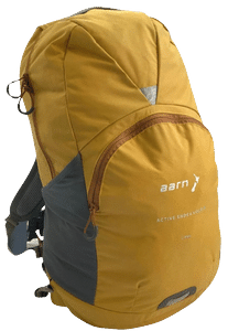
Walking Day Pack made in New Zealand