Home » North Island » Bay of Islands » Urupukapuka Island » Urupukapuka Bay Loop Walk
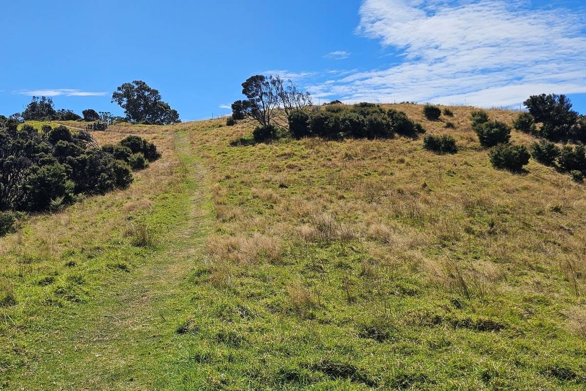
On Urupukapuka Island, I opted for the moderately challenging Urupukapuka Bay Loop Walk. The well-maintained track led me through a mix of native bush and rolling pastures, with scenic bays and rocky outcrops peeking through the trees.
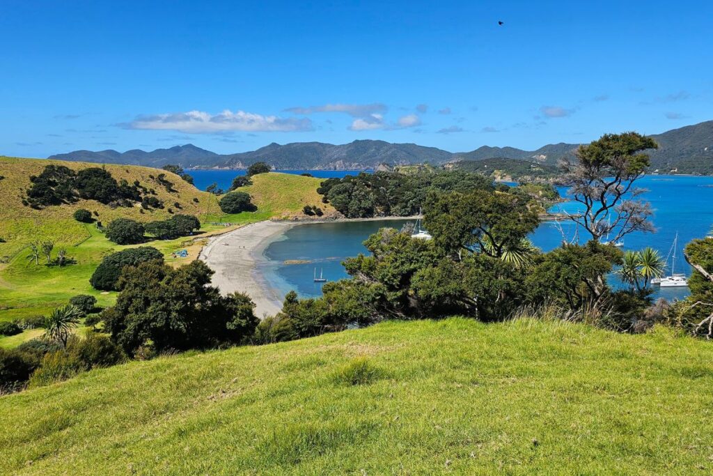
The highlight was definitely reaching the island’s high point, where I was rewarded with a breathtaking panorama of the Bay of Islands and Cape Brett stretching out in the distance. But also the views of the beach at Urupukapapka Bay with it’s crystal clear water was also amazing.
SAVE 40%: on last minute half day ferry tickets to Otehei Bay
| Location: | Urupukapuka Bay, Bay of Islands, North Island |
| Distance: | 2.5 km |
| Time: | 1 Hour |
| Difficulty: | Easy to Medium |
| Elevation: | 126m |
| Track Quality: | Excellent grassy track |
| Mountain bikes?: | No |
| Wheelchair access?: | No |
| Wet Feet: | No, nother |
| Toilets: | There are longdrop toilets at the campground at Urupukapuka Beach |
| Dogs: | No dogs allowed on the island |
| Mobile coverage: | Yes but patchy |
| Public transport: | You will need to get the ferry there or arrive in your own boat. |
SAVE 40%: on last minute half day ferry tickets to Otehei Bay
Reaching this paradise is straightforward by ferry. From Paihia, the main town in the Bay of Islands, ferries depart regularly to Urupukapuka Island, delivering you directly to Otehei Bay. Its a short uphill walk to the top of the hill to join the track.
Consider extending your walk by incorporating the Otehei Bay Loop walk which includes Cable Bay.