Home » North Island » Auckland Region » East Auckland » Botany » Mangemangeroa Reserve Walking Track
I was aware of it’s existence (and my awareness was raised further by my friend Isabel).

Today this coastal bush walk was an initial explore. We concluded that it cannot be made into a circular walk however it is a beautiful magical place to walk, so we will be returning to document it fully.
Yet again we hit the familiar snags, lack of sign posting – so we shall endeavor to keep fellow walkers on track with clear directions.
| Walk time: | 60 mins |
| Distance: | 5 km |
| Start: | Starts at 108 Somerville Road, Somerville, Auckland |
| Track Quality: | Wooden Stairs, gravel, dirt |
| Difficulty: | Easy |
| Buggies/Wheelchairs: | Not suitable |
| Dog Friendly: | Yes – welcome on leash |
| Facilities: | Toilets |

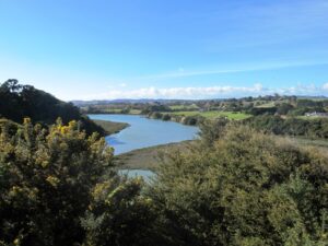
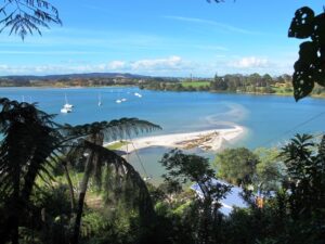
The views from the top of the ridge down the valley to the estuary were stunning, the bush was peaceful, and it was still and beautiful down by the water’s edge at Shelly Park Beach and the yacht club.
I also suggest if you have the time that you pop into Howick Village markets which are held every Saturday morning 8.00am – 12.30pm.
How to get there: Southern Motorway to South Eastern exit. Follow Route 10 to Ti Rakau Drive, turn right and keep going past Botany Town Centre to its end. Turn left onto Chapel Rd, right onto Whitford Rd then hard left onto Somerville Rd. (MAP)

A walkway runs through native bush, past mudflats stretching along the estuary to Cockle Bay. Or walk through paddocks dotted with cows. Ferries used to manoeuvre through the creek but now it’s home to mangroves, crabs and hosts of birds.
Beautiful lookouts and picnic spots. Dogs are allowed on a leash, except on the shoreline during bird breeding season, where they’re banned.
Where are all the maps? It would be good if your visitors actually knew where the walks went, rather than guessing.
Hi Neil, thanks for your question. Maps are included with all our guides which can be purchased from our online store. The guide for this walk has not yet been completed as it is a new discovery for us and we have to make a return visit to create a comprehensive guide. I can email you when that has been completed. Helen
FREE Auckland Walks eBook
Subscribe for walking and hiking tips.

Walking Day Pack made in New Zealand