Home » North Island » Manawatu Region » Tongariro National Park » Taranaki Falls Walk, Mt Ruapehu
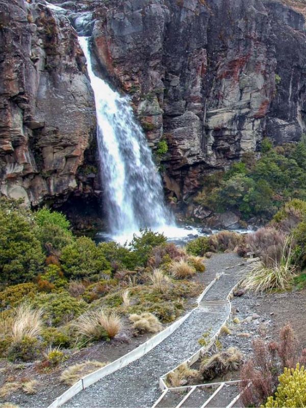
It wasn’t the greatest day when we set out on this walk, at least it wasn’t raining! On a clear day you can see the National Park township and the main road to Taupo from the waterfall. Perfect for kids too, its an easy walk.

If you’d rather do the Tongariro Crossing Walk as a guided walk, this is the best place to book it.
The views on the way driving into the beginning of the walk are stunning, especially if the mountains are snow-capped like the day we went. Stop and take a photo of the Chateau.
Drive past the Chateau and take the next turn to the left onto Ngauruhoe Place. Drive to the end of the road. A five minute drive all up.
There is an information board for you to read before you get under way.
The walk starts with red tussock grass and small patches of manuka. Then you walk into alpine shrub.
The track is a comfortable uphill walk to the falls with four small gullies to cross. In a couple of places, it can be a bit sticky, but it’s pretty good after the last upgrade.
Just around the corner, you can look back and just see the grand Chateau, be careful they might be watching you.
On a clear day, you would be able to see out to the National Park township and the main road to Taupo. Unfortunately it wasn’t so clear on the day we went.
After 1 hour of pleasant walking you’ll cross another bridge, this is the Wairere Stream.
Take a short walk around the lava flow it’s quite interesting. Don’t fall over the edge. Walk up to the marker post on the other side of the bridge.
From the marker post, turn left and hop down the mirrored of steeps to the falls. On the way down take a breather and sit down on the seat provided.
There are more tables and seats provided at the bottom, the only catch is, you might get wet from the spray off the falls.
If you have a plastic bag with you, rap the camera up nice and tight and walk under the falls and take a photo.
This is probably the best section of the walk. The beech forest is full of shiny broadleaf, mountain five fingers, ferns and the mighty Toatoa.
Native birds are also in abundance. Cascade Falls is only 5 minutes downriver from the falls once across the bridge it is plain sailing.
You will come across a turn off to the right; this track goes out to Mangatepopo Hut. An extremely rough track.
Just walk out onto the bridge for a view of the river. You are halfway now.
There are two gully’s to negotiate, then on to an open flat of red tussock grass, when you approach the Chateau, the car park is 30m over to the left, and you can cut through the buildings.
Taranaki Falls tumbles 20 metres
Summer is the best time to walk to the falls. It can get pretty cold and rainy at other times.
FREE Auckland Walks eBook
Subscribe for walking and hiking tips.

Walking Day Pack made in New Zealand