Home » North Island » Auckland Region » West Auckland » Hillsborough » Waikōwhai Walkway and Park
Waikowhai Park has a fantastic playground for older children that has an extra long slide and a flying fox. There is also a large off-leash dog exercise area. There are public toilets by the playground. It’s a great place for a picnic on a fine day – there are tables by the playground, seats along the undulating bush tracks and plenty of grass in the parkland.
As you stroll along the pathway, you’ll uncover hidden coves, city parks, patches of regrowing native forest, charming cliffside neighbourhoods, and peaceful viewpoints.
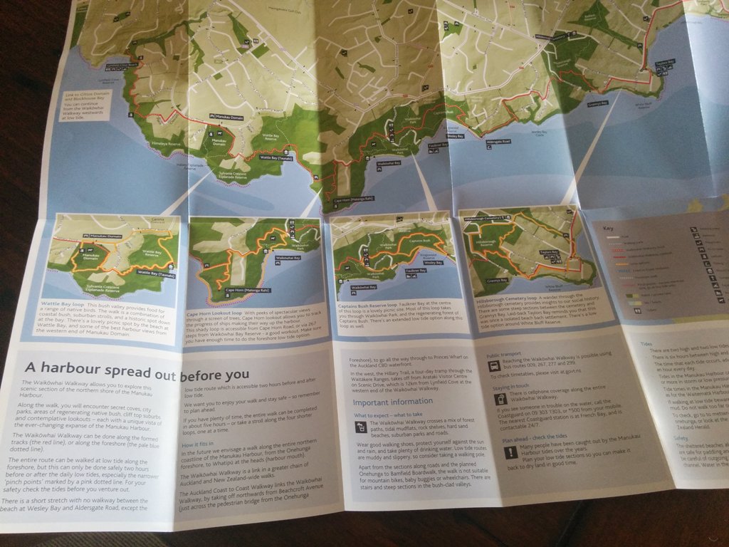
You have the choice to follow the established tracks or hug the shoreline while walking the Waikōwhai Walkway.
When the tide is low, you can venture along the foreshore for the entire route. But remember, this is safest only two hours before or after the daily low tides, especially at those narrower spots indicated by a pink dotted line on the map. Don’t forget to double-check the tide timings to ensure your safety before setting out on your adventure.
Keep in mind that there’s a brief section without a designated walkway between Wesley Bay’s beach and Aldersgate Road. However, during low tide hours, a route along the beach becomes accessible two hours prior to and following low tide.
| Walk time: | 5 hours |
| Distance: | 10 km |
| Track Quality: | Low tide routes are muddy and slippery |
| Difficulty: | Easy |
| Hazards: | Walk along the foreshore only two hours before or after low tide |
| Dog Friendly: | Dogs must be on-leash along the foreshore and through most of the walk |
| Facilities: | Toilets, picnic tables, parking, playground plus four more walking loop tracks |
| Map Location: | 8 Waikowhai Road, Hillsborough, Auckland, New Zealand |

You can download it on the Auckland Council website here. It shows tracks in detail plus provides information on the geology and ecology of the area. It was printed in 2016 so could be a bit out of date now. As at 2023 I couldn’t find a newer map.

You can walk along the Harbour foreshore at low tide only. The bush tracks to Wesley Bay tend to be muddy in winter, but there are concrete paths on the opposite side to the playground. If you enjoy bird spotting, then the bush tracks are the place to be.
Not suitable for mountain bikes, baby buggies or wheelchairs. This bush valley provides food for a range of native birds. The walk is a combination of coastal bush, suburban strolls, and a historic spot down at the bay. There’s a lovely picnic spot by the beach at Wattle Bay and some of the best harbour views from the western end of Manukau Domain.
Distance 2km. Access points are Cape Horn Road and Waikōwhai Road. With peeks of spectacular views through a screen of trees, Cape Horn lookout allows you to track the progress of coastal ships making their way up the harbour. This shady loop is accessible from Cape Horn Road, or via 267 steps from Waikōwhai Bay Reserve – a good workout. Make sure you have enough time to do the foreshore low tide option.
Faulkner Bay at the centre of this loop is a lovely picnic site. Most of this loop takes you through Waikōwhai Park and the regenerating forest of Captains Bush. There’s an extended low tide option along this loop as well. Not suitable for mountain bikes, baby buggies or wheelchairs.
A wander through the Hillsborough cemetery provides insights into our social history. There are some steep sections between the cemetery and Grannys Bay. Laid-back Taylors Bay reminds you that this was once an isolated beach bach settlement. There’s a low tide option around White Bluff Reserve.
FREE Auckland Walks eBook
Subscribe for walking and hiking tips.

Walking Day Pack made in New Zealand