- Access alert: DOC currently lists the northern end of the Whitecliffs Walkway, between the stock tunnel and Clifton Road at Tongaporutu, as closed, with no access from Tongaporutu. That is exactly the route described below, so check the DOC Whitecliffs Walkway page before you plan a trip.
- 15.1 km return, 4 to 5 hours, medium to hard
- Only walk the beach and tunnel sections at low tide
- No dogs, no toilets, no water, bring boots
- Part of our New Plymouth Walks guide
Quick facts
Getting there
From New Plymouth, drive north on State Highway 3 towards Hamilton for 68 km, about 55 minutes, until you reach Tongaporutu. Just before the Tongaporutu River bridge, turn left onto Clifton Road and follow it right out to the end.
You will pass through one gate on the way, open it and close it behind you. The second gate is locked, this is where you park. Be careful here, the car park sits right on the cliff top and there are no guard rails.
The walk
The White Cliffs Walkway runs from the Clifton Road car park at Tongaporutu, across working sheep and beef farmland, down to a black sand beach, through a tunnel in the cliff face, up the Waipingau Stream valley and over a ridge with views back across the whole route. Walking from this end gives you the best views of the 245 metre sandstone cliffs.
Car park to tunnel, 4.2 km, 1 hour
From the locked gate, follow the farm track towards the coast. About 10 minutes before the tunnel you reach a beautiful, secluded private beach. Keep going past a side road that heads uphill on the left. At the Y junction, go right, the left track is your return route later. Head up a slight incline to the tunnel entrance.
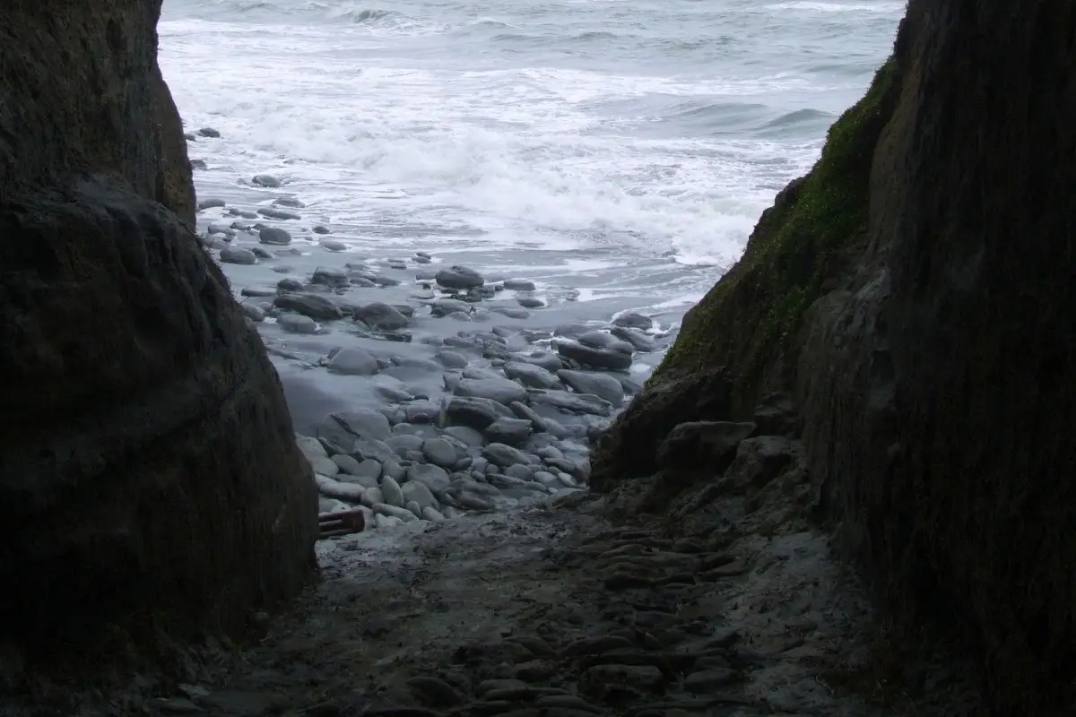
The tunnel looks worse than it is. It drops down quickly at the start and can be slippery when wet. If the tide is low enough you can come out the other side onto the beach and around to the next bay, but do not push further than that, it gets dangerous fast as the tide turns.
Tunnel to Waipingau Stream, 2.1 km, 1 hour
The first 20 minutes is over sandstone rocks before the going turns to black sand. This stretch is the best place to take in the scale of the white cliffs rising above you. Head along the beach to the Waipingau Stream, where the valley is almost wall to wall in nikau palms, a proper change from typical native bush walking.
Stream to swing bridge, 920 m, 20 minutes
Cross to the right hand side of the creek and follow the sandy track up onto the next level. From here the track is wide and grassy, easy to follow, though one section gets muddy. At the intersection, turn left. Right takes you up and over the ridge to the northern end of the track, straight ahead runs up to the main gas pipeline clearing, overgrown and not worth bothering with. From the intersection you can already see the swing bridge and signpost.
Swing bridge to ridge top, 2.4 km, 1 hour
From the swing bridge it is uphill all the way to the top, a climb of about 220 metres. Most of the track is grassy with wooden steps through the steeper sections. The track follows the line of a gas pipeline for part of this climb, so it stays wide even where it gets steep. Keep glancing left on the way up to pick out the creek you walked earlier. The best views and photos are right at the top, do not rush past them, you should be able to spot your car from up here. Look right and you will see Mount Messenger at 310 metres, where State Highway 3 runs through a tunnel on the way out to Tongaporutu, the same one you drove through earlier.
Ridge top back to beach and car park, 4.2 km, 1 to 2 hours
From the top it is downhill all the way back to the beach, then retrace your steps along the sand to the car park. This area is popular with pig hunters, Sandra met two young guys carrying out a wild boar their dogs had caught that morning on one trip.
What you’ll see
The main drawcard is the 245 metre high white sandstone cliffs, which date back 10 million years. There is a striking rock formation out in the middle of a secluded beach, and a tunnel through the cliff that opens onto black sand. If you are into fossils, look around the sandstone boulders at the base of the cliffs. The Waipingau Stream valley is thick with nikau palms, a real contrast to standard native bush. From the ridge top you get views back over your whole route and across farmland to Mount Messenger.
Who it’s for
This suits fit, experienced walkers who are comfortable timing a route around the tide and happy with a solid climb at the end. It crosses working farmland with gates to manage, a tunnel section, and a reasonable ridge climb, so it is not a casual family stroll. Good boots are essential, especially if there has been rain.
When to go
Low tide is essential. The beach and tunnel sections are only safely passable within about two hours either side of low tide, so check Port Taranaki tide times before you set out and build your day around them. Early morning tends to give the best light on the cliffs. The walkway is also closed every year from 1 July to 30 September for lambing and other farm work, since the route crosses private farmland.
Important stuff
- Check current access first. DOC lists the northern section between the tunnel and Clifton Road as closed with no access from Tongaporutu, and a recent visitor report also describes the tunnel route as closed because of the risk of collapse. Check DOC’s Whitecliffs Walkway page before you commit to this route.
- Tides. Only walk the beach and tunnel sections at low tide, and allow time either side of it. Do not get caught by a rising tide at the base of the cliffs.
- Cliff erosion. There is active erosion along the beach section below the cliffs, rocks can and do continue to fall, so keep your distance from the cliff base and keep moving through that stretch.
- Seasonal closure. The walkway crosses farmland and is closed from 1 July to 30 September each year for lambing.
- Gates. There are two gates on Clifton Road, open and close the first behind you, the second is locked and is where you park.
- Dogs are not permitted anywhere on this walk.
- No toilets, no water and no shop out this way, come prepared and carry everything you need.
- Tongaporutu is also where the New Plymouth council has been trying to remove old river bank baches built years ago, a point of some local disagreement with the owners.
Common questions
Is the White Cliffs Walkway currently open?
Check before you go. DOC states the northern end of the walkway, between the stock tunnel and Clifton Road at Tongaporutu, is closed with no access from that end, and a recent report describes the tunnel itself as closed due to collapse risk. Confirm current status on DOC’s website before driving out.
When is the walkway closed for the season?
It is closed every year from 1 July to 30 September for lambing, since the track crosses private farmland.
What are the tide times like at Tongaporutu?
The beach and tunnel sections are only safe within about two hours either side of low tide. Check Port Taranaki tide times before you set out and plan your walk around them.
Are dogs allowed on the White Cliffs Walkway?
No, dogs are not permitted on this track.
How long does the White Cliffs Walkway take?
Allow 4 to 5 hours for the full 15.1 km return trip from the Clifton Road car park.
My honest take
I walked this from the Tongaporutu end, which I’d recommend if you want the best views of the cliffs. The variety is what stays with me, farm paddocks, a hidden beach, that tunnel, the nikau valley along the stream, then a solid climb up to views over the whole route and across to Mount Messenger. The tunnel looks more intimidating than it is, but I would not want to be caught out there on a rising tide. We ran into a couple of young guys carrying out a wild boar their dogs had caught that morning, this is proper pig hunting country. It is a long day and the terrain and tides mean you need to plan it properly, but it is one of the better coastal walks I have done in Taranaki.
Other walks nearby
See more of our New Plymouth Walks.